Introduction to Geospatial Technologies
Cross Listings: NRES 218
Prerequisites: Basic computer skills (spreadsheets, word processors, data and file management)
Description: Theory and applications of geospatial information technology (GIT) with emphasis on real-world applications to natural resources. Overview of GIT, focusing on introduction of remote sensing, the global positioning system (GPS), and geographic information systems (GIS). Introduction to data collection, spatial data representation, georeferencing, spatial data analysis, and remote sensing image analysis.
Teaching Method: Classroom or Online
Credit Hours: 3
Taught: Fall and Spring semesters
Introduction to Cartography
Cross Listings: GEOG 317
Prerequisites: 6 hrs Geography.
Description: This course explores mapping concepts and technology, teaching students how to develop and communicate effectively with cartography as well as how to critically interpret historical and contemporary maps.
Teaching Method: Lecture and Lab
Credit Hours: 4
Taught: Fall Semesters
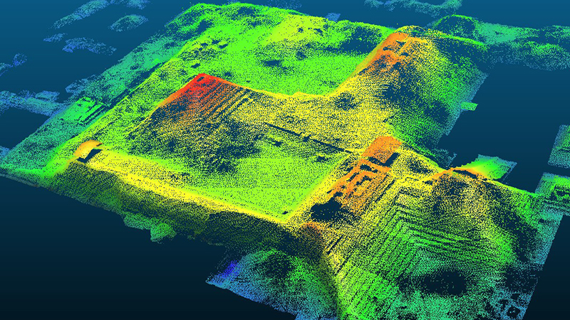
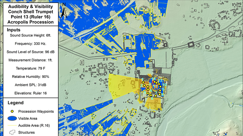
GIS in Archaeology
Cross Listings: ANTH 389/889
Prerequisites: No Prerequisites but Intro GIS course or equivalent experience recommended
Description: This class provides an introduction to GIS and other geospatial data, for example, Global Positioning Systems (GPS) and airborne LiDAR and teaches students skills for data acquisition, data integration, spatial analysis, and dissemination. Employing a range of methods, we analyze how spatial and temporal patterns of material remains and environmental factors reflect and shape cultural practices.
Teaching Method: Lecture and Lab
Credit Hours: 3
Taught: Various Semesters
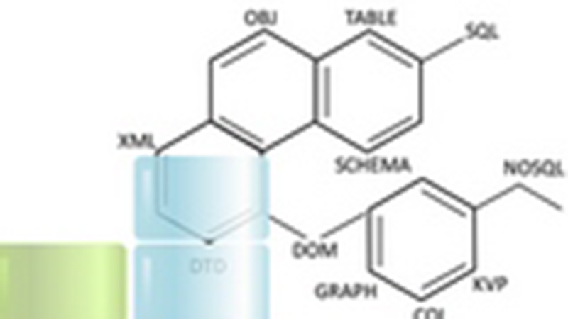
Data Modeling for Systems Development
Cross Listings: CSCE 411/811
Prerequisites: CSCE 310, CSCE 310H, CSCE 311, SOFT 260, SOFT 260H or RAIK 283H
Description: Concepts of relational and object-oriented data modeling through the process of data model development including conceptual, logical and physical modeling. Techniques for identifying and creating relationships between discrete data members, reasoning about how data modeling and analysis are incorporated in system design and development, and specification paradigms for data models. Common tools and technologies for engineering systems and frameworks for integrating data. Design and analysis of algorithms and techniques for identification and exploration of data relationships, such as Bayesian probability and statistics, clustering, map-reduce, and web-based visualization.
Teaching Method: Lecture
Credit Hours: 3
Taught: Fall/Spring Semester
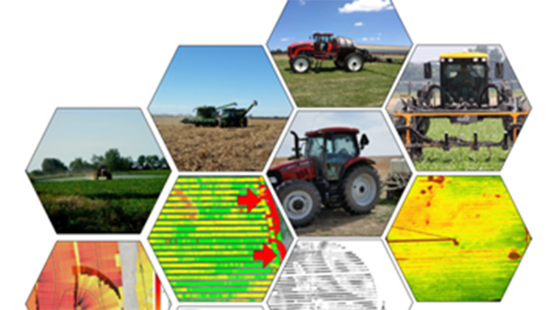
GIS in Agriculture and Natural Resources
Cross Listings: GEOG 412/812 | NRES 412/812
Prerequisites:
Description: Principles of digitizing earth observations. Manipulate spatial data, create maps, and conduct spatial analyses. Use GIS to analyze and solve real-world questions in agriculture and natural resources.
Teaching Method: Lecture and Lab
Credit Hours: 4
Taught: Fall Semester
Cartography II: Electronic Atlas Design and Production (Web GIS)
Cross Listings: GEOG 417/817
Prerequisites: GEOG 317
Description: This course introduces students to Internet-based GIS, focused heavily on programming concepts underlying the creation and implementation of quality web mapping applications
Teaching Method: Lecture
Credit Hours: 3
Taught: Spring Semesters
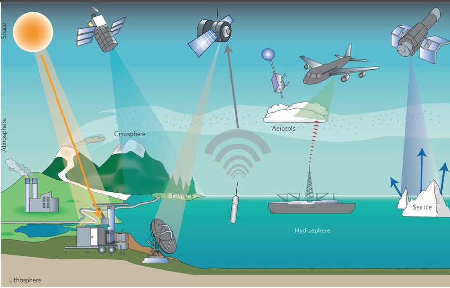
Introduction to Remote Sensing
Cross Listings: GEOG 418/818 | NRES 418/818
Prerequisites: 9 hours of GEOL, NRES or GEOG.
Description: Introduction to remote sensing of the earth from aerial and satellite platforms. Aerial photography, multispectral scanning, thermal imaging and microwave remote sensing techniques. Physical foundations of remote sensing using electromagnetic energy, energy-matter interactions, techniques employed in data acquisition and methods of image analysis. Weekly laboratory provides practical experience in visual and digital interpretation of aerial photography, satellite imagery, thermal and radar imagery. Applications in geographic, agricultural, environmental and natural resources analyses.
Teaching Method: Lecture and Lab
Credit Hours: 4
Taught: Fall semesters
Applications of Remote Sensing in Agriculture and Natural Resources
Cross Listings: AGRO 420/820 | GEOG 420/820 | GEOL 420/820 | NRES 420/820
Prerequisites: GEOG/NRES 418 recommended
Description:
Teaching Method: Lecture and Lab
Credit Hours: 4
Taught: Spring Semesters - Even Years
Field Techniques in Remote Sensing
Cross Listings: GEOG 421/821 | NRES 421/821
Prerequisites: GEOG 418/818
Description: Field techniques as they relate to remote-sensing campaigns. Research methods, systematic approaches to data collection, field spectroscopy, collecting ancillary information linked with spectroscopic data sets as well as aircraft or satellite missions and subsequent analyses of acquired data.
Teaching Method: Lecture and Lab
Credit Hours: 3
Taught: Summer Semester
Advanced Techniques in Geographic Information Systems
Cross Listings: GEOG 422/822
Prerequisites: GEOG 412/812
Description: Project-based course that emphasizes advanced techniques and theories underlying Geographic Information Science. Data structures, advanced spatial analysis, and project development form the basis of the course. Students will develop a semester-long project related to their research interests.
Teaching Method: Lecture and Lab
Credit Hours: 4
Taught: Spring Semester
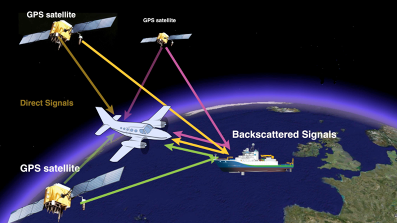
Introduction to the Global Positioning System (GPS)
Cross Listings: GEOG 427/827 | NRES 427/ 828
Prerequisites: Junior
Description: Integrated lectures, lab exercises and field experience provide an understanding of GPS technology and applications. Students will learn to collect, correct and use GPS data in a geographic information system (GIS) environment.
Teaching Method: Lecture
Credit Hours: 2
Taught: Spring Semester
Planning with GIS
Cross Listings: CRPL 430/830
Description: This is an introductory course on Geographic Information System (GIS) and shows the capabilities of GIS from a broad and practical perspective. It provides a fundamental and practical understanding of GIS concepts, technical issues, and applications in various disciplines. It does so by providing hands-on training and then relating these skills to the more general context of theoretical concepts and current professional practice. By the end of the semester, it is expected that students will have the ability to design and perform spatial analysis using GIS in each major fields.
Teaching Method: Lecture and Lab
Credit Hours: 3
Taught: Fall and Spring Semester
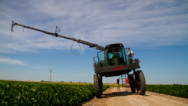
Site-Specific Crop Management
Cross Listings: AGRO 431 | MSYM 431 | AGEN 431
Prerequisites: AGRO/SOIL 153 and AGRO 204. The course is limited to senior level only or by permission
Description: The course overviews principles and applications of precision agriculture. It focuses on hands-on experience using hardware/software and information management systems for mastering the essential skills to adopt site-specific crop management.
Teaching Method: Lecture and Lab
Credit Hours: 3
Taught: Fall Semesters
Advanced Spatial Analysis with GIS
Cross Listings: CRPL 432/832
Prerequisites: Introductory level GIS course or equivalent
Description: This course provides advanced level instruction on the knowledge and advanced methods needed for the complex geospatial analysis in developing and utilizing geographic information. This course combines lectures, practical application and hands-on training to improve advanced analytic skills to be used in research, policy and professional practice. The main subjects to be covered include advanced raster data analysis, spatial-statistical analysis, network analysis, 3D modelling and visualization, and programming.
Teaching Method: Lecture and Lab
Credit Hours: 3
Taught: Spring Semester
GIS Programming for Advanced Spatial Analysis and Modeling
Cross Listings: GEOG 432/832
Prerequisites: GEOG 412/812 or NRES 412/812
Description: Programming and scripting to automate and standardize geospatial analysis and data management. The fundamentals of scripting and object-oriented programming using the Python programming language are taught. Applications will use the ArcPy library and R programming language to access geoprocessing tools.
Teaching Method: Lecture
Credit Hours: 4
Taught: Spring Semester
Spatial Statistics
Cross Listings: STAT 432 | STAT 831
Prerequisites: for STAT 432: STAT 463 (could be concurrent) | for STAT 831: STAT 802 and knowledge of matrix algebra or STAT 821
Description: Learn statistical theory, methods and applications for geostatistical data, lattice data and point pattern. The focus would be on methods and applications, but necessary and essential theories and proof will also be covered. After the class, audiences are expected to
- grasp the main theory and methods in spatial statistics
- be able to model and analyze real world spatial data sets with R, and accurately summarize the results
- be able to read and understand journal papers on spatial analysis in their own research area
Teaching Method: Lecture
Credit Hours: 3
Taught: Spring Semester (every other year)
GIS in Environmental Design and Planning
Cross Listings: CRPL 433/833
Description: This course provides an introduction of GIS theory and method in environmental survey, assessment, design and planning. Students will use GIS to analyze the critical environmental elements, their interrelationships, and human interactions in environmental design and planning. This course emphasizes synthesizing spatial analysis skills and environmental assessment knowledge into a coherent concept for practical applications. By the end of the course, it is expected that students will have the ability to use GIS to perform environmental inventory analysis, land suitability assessment, and site planning.
Teaching Method: Lecture and lab
Credit Hours: 3
Taught: Spring Semester
Hydrology
Cross Listings: NRES 453/853
Description: Students who complete this course will be competent in discussing and applying the basic concepts of watershed hydrology and hydrologic processes, and will have a basic understanding of the earth’s hydrologic cycle and its components .
Teaching Method: Lecture
Credit Hours: 3
Taught: Spring Semester
Geospatial Approaches in Digital Humanities & Social Science
Cross Listings: ANTH 461/861 | CLAS 461/861 | GEOG 461/861 | HIST 461/861
Prerequisites: No Prerequisites but Intro GIS course or equivalent experience recommended
Description: This course centers on the “Spatial Turn” in the Humanities and Social Sciences. Students learn geospatial concepts and explore how scholars are creatively applying Geographic Information Systems (GIS) as well as use GIS and other digital tools to gather, create, and analyze spatial data to carry out research based on students' scholarly interests.
Teaching Method: Lecture and Lab
Credit Hours: 3
Taught: Various Semesters
Regional Climatology
Cross Listings: METR 478/878 | NRES 478/878
Prerequisites: Junior standing or above
Description: Students will understand characteristics of the regional climates of the world and appreciate how these climates have influenced human society and natural ecosystems in unique ways. Students will demonstrate through discussions, presentations, and projects how a knowledge of regional climatology will improve decision-making and benefit local, regional, and global futures.
Teaching Method: Lecture
Credit Hours: 3
Taught: Spring Semester (odd years)
GIS for Agriculture and Natural Resources
Cross Listings: NRES 498/898 (Special Topics)
Prerequisites: NRES 312 recommended.
Description: Understand the principles of digitizing earth and spatial organization in geographic information science; Develop knowledge to effectively manipulate spatial data, create maps, and conduct spatial analysis; Apply skills in GIS to analyze and solve real-world questions in agriculture and natural resources
Teaching Method: Lecture and Lab
Credit Hours: 4
Taught: Fall/Spring Semester
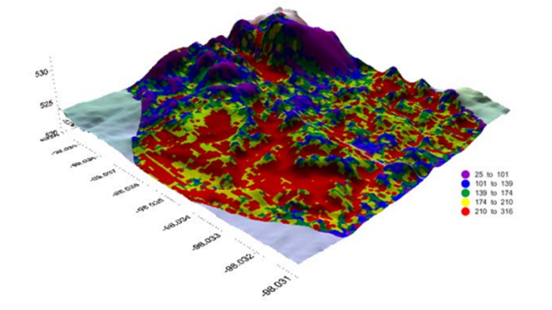
Spatial Variability in Soils
Cross Listings: AGRO 831
Prerequisites: AGRO/SOIL 366 and STAT 801.
Description: This course will examine the basic concepts of soil spatial variability and it’s underlying causes and impacts soil variability has on management, primarily for crop production.
Teaching Method: Online
Credit Hours: 2
Taught: Spring semesters, even-numbered years